Farming today faces a complex mix of pressure from climate change, rising input costs, and the need to produce consistent crop yields. Technology now plays a practical role in helping them make confident decisions in everyday operations. This shift has introduced precision farming technology into mainstream farming conversations, where digital tools support real farm challenges and align closely with the broader evolution of digital agriculture across global farming systems.
Farmers are increasingly working with experience and data. Precision farming combines satellite mapping, soil monitoring, and digital tools to understand farm conditions more clearly. These insights allow them to act at the right time rather than responding after problems occur.
According to Kings Research, the global precision farming market size was valued at USD 11.68 billion in 2024 and is projected to reach USD 33.13 billion by 2032, growing at a CAGR of 14.01% during the forecast period.
Recent federal assessments show that adoption of these tools still varies across farm operations. In 2023, about 27 percent of U.S. farms or ranches reported using precision farming practices for crop or livestock management, showing steady but uneven adoption across the country. Adoption levels also differ based on operational scale and management objectives, highlighting how technology uptake depends on farm size and investment capacity. (Source: gao.gov)
What Precision Farming Really Means
Precision farming focuses on understanding variation within farmland rather than treating entire fields identically. Soil quality, moisture levels, and crop performance often differ across even small sections of land. Farmers who understand these differences can make better decisions for planting and crop management. Precision farming technology provides tools that capture and analyze field data so farmers can manage each area according to its needs. This allows crops to grow in conditions suited to them while reducing unnecessary input use.
Farmers still rely on their experience, seasonal understanding, and familiarity with land conditions. Technology supports those instincts with measurable information. GPS mapping systems, soil sensors, and monitoring platforms guide farmers when crops need irrigation or nutrients. Precision farming minimizes guesswork and reduces weather-related risks, and promotes sustainable resource use, ensuring consistent crop productivity over time.
How Technology Works on Modern Farms
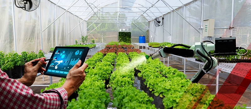
Modern farms use multiple data sources to understand crop and soil conditions. Soil sensors measure moisture levels and nutrient availability beneath the surface. Drones capture aerial images that reveal plant stress or uneven growth patterns. Advanced solutions now include robotic drones for farming that automate large-scale crop monitoring with minimal manual intervention.
The Food and Agriculture Organization (FAO) also recognizes robots, drones, AI, and automation systems as key components of precision agriculture that work together to enable variable rate application, navigation, and automated farm operations across crop cycles. Precision agriculture technology gathers this information into centralized dashboards, allowing farmers to monitor their fields through mobile devices while standing on site or planning activities remotely.
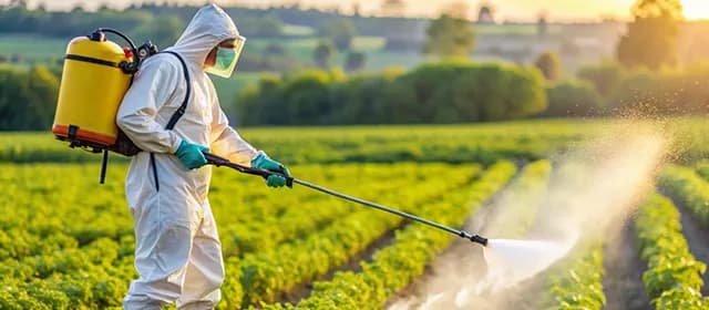
Farm machinery also integrates digital systems for improved efficiency. Modern agricultural machinery, including GPS-guided agricultural tractors, plants seeds in consistent patterns, reducing overlap and saving fuel. GPS-guided tractors plant seeds in consistent patterns, reducing overlap and saving fuel. Smart spraying systems apply crop protection only where crops show disease or pest risks. These systems operate quietly while farmers focus on broader farm management decisions. Precision agriculture technology creates a connected system where machinery, data platforms, and monitoring tools work together to improve farming precision and simplify operations.
Federal agricultural data further shows how widely guidance systems are already integrated into crop production. USDA research indicates that GPS-based guidance and auto-steer systems now cover the majority of planted acres for major U.S. row crops, meaning more than half of the acreage for crops such as corn, soybean, wheat, and cotton already uses guidance systems during production. This demonstrates how precision farming technology has moved from experimentation to mainstream practice in large-scale crop farming. (Source: usda.gov)
Key Tools Supporting Precision Farming Practices
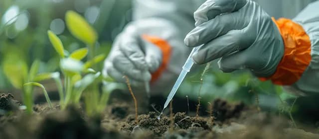
Several technologies now support precision farming practices across different types of agriculture. GPS mapping tools allow farmers to identify soil variations and plan crop layouts carefully. Soil monitoring sensors provide real-time updates on moisture and nutrient conditions so irrigation schedules match actual crop needs. Drone and satellite imaging reveal plant stress earlier than visual inspection alone, helping farmers respond before crop damage spreads. These tools form an integrated decision-making system guided by precision farming technology.
Farm management software also plays a major role in organizing data from different sources. Farmers can analyze crop performance trends, track fertilizer use, and plan future seasons using historical data. Smart irrigation systems automate watering schedules based on soil conditions, reducing both water waste and labor effort. When combined, these systems allow farms to operate efficiently without constant manual monitoring. Precision farming technology helps farmers coordinate multiple activities smoothly while maintaining consistent crop health across growing seasons.
Benefits Farmers Experience from Precision Farming
Farmers adopting data-supported farming methods often achieve greater crop consistency and operational efficiency. Crops receive inputs according to measured needs rather than routine schedules. This results in healthier growth patterns and better use of fertilizers and crop protection products. Precision agriculture technology also improves water management by guiding irrigation based on soil moisture, conserving water while preventing crop stress.
Operational efficiency also improves when automated systems handle repetitive tasks such as planting alignment, irrigation scheduling, and even precision harvesting, allowing farmers to reduce post-harvest losses while maintaining crop quality. Environmental benefits also become noticeable because careful input application reduces soil degradation and protects nearby ecosystems.
Through careful monitoring and data-based decisions, precision agriculture technology supports long-term sustainability while maintaining profitability, allowing farmers to balance productivity with responsible land management practices.
Precision Farming Adoption in India and Emerging Regions
Digital farming solutions are gradually expanding across India as farmers seek practical ways to improve productivity and manage unpredictable weather patterns. Agri technology startups and government-supported programs now introduce farmers to mobile advisory tools and affordable sensor solutions, accelerating the shift toward smart agriculture practices suited to local farming conditions. Precision farming technology becomes accessible through simplified platforms designed for local farming conditions. Farmers growing fruits, vegetables, and staple crops increasingly experiment with crop monitoring and irrigation management technologies to reduce losses.
Training programs and demonstration farms help farmers understand how digital tools work in real field conditions. Adoption grows steadily when farmers witness practical results rather than theoretical promises. Service providers also offer drone monitoring and advisory services without requiring farmers to purchase expensive equipment. Precision agriculture technology continues spreading in emerging markets as awareness grows and solutions become simpler to use, encouraging farmers to adopt tools gradually while maintaining traditional farming knowledge.
Challenges Farmers Still Encounter in Adoption
Technology adoption still presents challenges, especially for smaller farms operating with limited budgets. Initial investment costs sometimes discourage farmers from experimenting with new tools. Reliable internet connectivity also remains inconsistent in certain rural areas, limiting the smooth use of digital platforms. Training and technical support also influence adoption success. Precision farming technology becomes easier to accept when farmers receive proper guidance and see clear improvements in crop management outcomes.
Organizations, agricultural universities, and startups now conduct workshops and training sessions to support farmers learning new systems. Farmers also prefer solutions that integrate easily into existing workflows without adding complexity. Equipment manufacturers continue simplifying systems to reduce learning barriers. Despite challenges, adoption of precision farming technology is growing, driven by more affordable, user-friendly tools and reinforced by practical field success stories.
Federal surveys further confirm adoption differences across farm sizes. Around 70 percent of large crop-producing farms use GPS autosteering systems, while about 52 percent of midsize farms use these systems, with significantly lower adoption levels observed among smaller operations. These numbers demonstrate how precision farming technology adoption increases with farm scale, since larger operations often have greater capacity to invest in advanced tools.
Similar federal data also shows that GPS-based guidance systems and soil or yield mapping tools are used on about 52 percent of midsize farms and roughly 68 percent of large farms, while smaller farms continue to report lower adoption levels. These patterns reinforce how operational size influences technology adoption decisions across farming and agriculture in general.
Sustainable Farming and Resource Conservation
Sustainability concerns continue to shape agricultural practices worldwide as farmers manage soil health and water resources carefully. Precision farming allows farmers to conserve inputs while maintaining crop productivity. Soil monitoring helps maintain nutrient balance, reducing excessive fertilizer application that can damage ecosystems while encouraging the use of sustainable inputs such as organic fertilizers in modern farming practices. Precision farming technology supports responsible farming by helping growers deliver resources precisely where crops need them, minimizing environmental impact while supporting long term farm viability.
Climate change and water scarcity make efficient resource management essential for future farming practices. Digital monitoring systems help farmers detect crop stress early and respond before conditions worsen. Reduced chemical usage also protects biodiversity and groundwater quality. Precision farming technology contributes to farming practices that balance crop production with environmental protection, ensuring that farmland remains fertile and productive for future generations while maintaining economic stability for farming communities.
Future Trends Shaping Precision Farming
Precision farming continues to evolve as emerging technologies expand possibilities in farm management. Artificial intelligence systems analyze crop data and weather patterns to guide future planting decisions. Robotics and automated harvesting machines, along with emerging autonomous farm equipment, are gradually entering commercial farming operations, reducing labor dependency while improving operational precision. Cloud-based platforms allow farmers to access and analyze farm data from any location. Precision farming technology continues to advance as companies develop practical solutions that integrate seamlessly into farming workflows.
Younger farmers show strong interest in technology-driven agriculture because digital tools align naturally with modern business management approaches. Innovation focuses on affordability and accessibility, enabling farms of all sizes to benefit. As precision farming technologies become user-friendly and cost-effective, they are viewed as a natural extension of farming practices, transforming the sector into a data-informed and resilient industry.
Final Thoughts on Smart Farming Adoption
Agriculture is evolving through collaboration among farmers, researchers, and technology providers. Data-supported farming practices help address productivity concerns while protecting natural resources. Farmers remain at the center of agricultural decision-making, using technology to inform rather than replace their expertise. Precision farming tools provide detailed insights into land conditions and respond with precision throughout crop cycles.
Smart farming is expanding across regions as successful implementation drives wider acceptance. Farmers share insights and tailor digital tools to their crops and land conditions. Discussions now emphasize measurable outcomes rather than long-term projections. Precision farming enables more productive, resource-efficient operations, supporting farmer livelihoods and promoting sustainable, resilient global agriculture.


